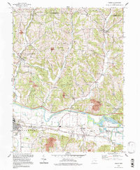
1994 Map of Fresno
USGS Topo · Published 1998About this map
The Tuscarawas River carves a wide path through the southern reaches of this landscape, separating the flat expanse of The Plains from the dissected uplands of Progressive Valley. In the mid-1990s, the industrial character of the region is evident through numerous Strip Mines and the presence of the West Lafayette settlement. This area lies within the United States Military District, a historical designation that influenced early land divisions.
Find a feature on this map
48 named features on this map. Tap any name to fly to it.
Don’t see what you’re looking for? This feature index may not catch every label — zoom into the map to look around manually.
Map Details
Editions of this 1994 Fresno Map
This is the sole edition of this map. No revisions or reprints were ever made.
Other maps of this area

1908 · Conesville
USGS Topo · 1:62,500

1909 · Cambridge
USGS Topo · 1:62,500

1910 · Conesville
USGS Topo · 1:62,500

1911 · Newcomerstown
USGS Topo · 1:62,500

1912 · Cambridge
USGS Topo · 1:62,500

1913 · Newcomerstown
USGS Topo · 1:62,500

1913 · Coshocton
USGS Topo · 1:62,500

1915 · Coshocton
USGS Topo · 1:62,500

1943 · Coshocton
USGS Topo · 1:62,500

1943 · Newcomerstown
USGS Topo · 1:62,500