1955 Map of Fresno
USGS Topo · Published 1955About this map
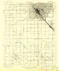
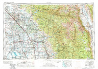
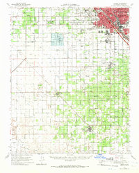
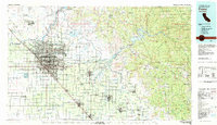
Fresno and the fertile Central Valley serve as the western anchor of this 1955 survey, where an extensive irrigation and rail network supported a booming agricultural economy. The Southern Pacific RR and Atchison Topeka and Santa Fe Ry parallel U S Highway 99, linking established trade centers like Hanford, Visalia, and Tulare. To the south, the basin of Tulare Lake is shown during a period of significant hydrological modification. The landscape shifts dramatically eastward as the valley floor meets the high peaks of the Sierra Nevada. This survey documents the mid-century boundaries of Sequoia National Park and Kings Canyon National Park, including the massive granite heights of Mt Whitney and Mt Williamson along the Great Western Divide. In the foothills, the newly formed Pine Flat Reservoir on the Kings River reflects the era's massive water management projects.
Find a feature on this map
131 named features on this map. Tap any name to fly to it.
Don’t see what you’re looking for? This feature index may not catch every label — zoom into the map to look around manually.
Map Details
Editions of this 1955 Fresno Map
This is the sole edition of this map. No revisions or reprints were ever made.
Historical Maps of Nanceville Through Time
10 maps found