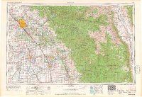
1966 Map of Fresno
USGS Topo · Published 1966About this map
Fresno serves as the primary hub of the San Joaquin Valley in the mid-1960s, anchoring an extensive grid of agricultural irrigation and rail lines. This survey captures a landscape of extreme contrasts, from the industrial agricultural centers of Visalia, Hanford, and Tulare to the high elevations of the Sierra Nevada. The eastern half of the map is dominated by the protected wilderness of Kings Canyon National Park and Sequoia National Park, featuring the formidable Mount Whitney.
Find a feature on this map
190 named features on this map. Tap any name to fly to it.
Don’t see what you’re looking for? This feature index may not catch every label — zoom into the map to look around manually.
Map Details
Editions of this 1966 Fresno Map
This is the sole edition of this map. No revisions or reprints were ever made.
Other maps of this area

1903 · Tehipite
USGS Topo · 1:125,000

1904 · Kaiser
USGS Topo · 1:125,000

1904 · Kaweah
USGS Topo · 1:125,000

1905 · Tehipite
USGS Topo · 1:125,000

1905 · Olancha
USGS Topo · 1:125,000

1905 · Fairview
USGS Topo · 1:24,000

1906 · Kernville
USGS Topo · 1:125,000

1907 · Olancha
USGS Topo · 1:125,000

1907 · Mt. Whitney
USGS Topo · 1:125,000

1908 · Lida
USGS Topo · 1:250,000