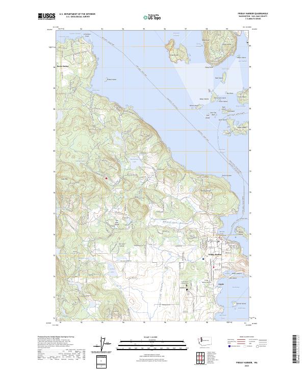
2023 Map of Friday Harbor
USGS Topo · Published 2023About this map
Friday Harbor serves as the primary hub of this maritime landscape, anchored by the San Juan County Courthouse and the local Friday Harbor Airport. The map highlights a complex archipelago where the Anacortes - Friday Harbor Ferry and the Anacortes - Sidney Ferry provide essential links between the islands and the mainland. To the northwest, the settlement of Roche Harbor sits near Limestone Point, while the interior of San Juan Island is defined by the high ground of Cady Mtn and the agricultural expanse of Beaverton Valley. Significant portions of the smaller surrounding islands, including Jones Island and Shaw Island, are protected within the San Juan Islands National Wildlife Refuge and San Juan Islands Wilderness. Genealogists may find value in the locations of the San Juan Cem and Saint Francis Catholic Cem near the southern coast.
Find a feature on this map
70 named features on this map. Tap any name to fly to it.
Don’t see what you’re looking for? This feature index may not catch every label — zoom into the map to look around manually.
Map Details
Editions of this 2023 Friday Harbor Map
This is the sole edition of this map. No revisions or reprints were ever made.
Other maps of this area

1943 · Richardson
USGS Topo · 1:62,500

1943 · Orcas Island
USGS Topo · 1:62,500

1953 · Stuart Island
USGS Topo · 1:24,000

1954 · Roche Harbor
USGS Topo · 1:24,000

1954 · Waldron Island
USGS Topo · 1:24,000

1954 · Friday Harbor
USGS Topo · 1:24,000

1954 · False Bay
USGS Topo · 1:24,000

1957 · Richardson
USGS Topo · 1:62,500

1957 · Orcas Island
USGS Topo · 1:62,500

1957 · Victoria
USGS Topo · 1:250,000