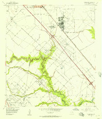
1955 Map of Friendswood
USGS Topo · Published 1957About this map
Industrial and aviation development dominates the mid-century landscape of this Texas coastal plain, where the Friendswood Oil Field and Hastings Field define the local economy through a network of pipelines and salt water disposal wells. Ellington Air Force Base occupies a significant portion of the northeastern territory, featuring an extensive runway system and supporting facilities like the Airway Beacon. The settlement of Friendswood is shown as a small, developing hub along the banks of Clear Creek, which serves as a natural boundary between Harris, Brazoria, and Galveston counties.
Find a feature on this map
31 named features on this map. Tap any name to fly to it.
Don’t see what you’re looking for? This feature index may not catch every label — zoom into the map to look around manually.
Map Details
Editions of this 1955 Friendswood Map
3 editions found
Other maps of this area

1915 · Park Place
USGS Topo · 1:24,000

1915 · Deepwater
USGS Topo · 1:24,000

1916 · Genoa
USGS Topo · 1:24,000

1916 · Seabrook
USGS Topo · 1:24,000

1916 · La Porte
USGS Topo · 1:24,000

1919 · Deepwater
USGS Topo · 1:31,680

1920 · Seabrook
USGS Topo · 1:31,680

1920 · Genoa
USGS Topo · 1:31,680

1920 · Mykawa
USGS Topo · 1:31,680

1920 · La Porte
USGS Topo · 1:31,680