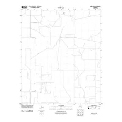
2010 Map of Frier Ranch
USGS Topo · Published 2010About this map
Frier Ranch serves as the namesake hub of this section of the Permian Basin in southeastern New Mexico. The landscape is defined by the industrial grid of energy extraction, specifically the Hightower East Oil Field to the north and the Lazy J Oil Field in the southwest. A network of arterial routes, including County Rd-152 and County Rd-159, connects these remote operations through the arid terrain. Further east, the Cerca Oil Field underscores the persistent role of the petroleum industry in shaping the local economy and land use. The map reveals the characteristic spatial organization of high-desert ranching and resource development, where long stretches of road like County Rd-149 link isolated facilities and homesteads.
Find a feature on this map
10 named features on this map. Tap any name to fly to it.
Don’t see what you’re looking for? This feature index may not catch every label — zoom into the map to look around manually.
Map Details
Editions of this 2010 Frier Ranch Map
This is the sole edition of this map. No revisions or reprints were ever made.
Other maps of this area

1954 · Brownfield
USGS Topo · 1:250,000

1958 · Brownfield
USGS Topo · 1:250,000

1962 · Brownfield
USGS Topo · 1:250,000

1970 · Simanola Valley
USGS Topo · 1:24,000

1970 · Alston Ranch
USGS Topo · 1:24,000

1970 · Hillburn City SW
USGS Topo · 1:24,000

1973 · Fort Ranch
USGS Topo · 1:24,000

1973 · Soldier Hill
USGS Topo · 1:24,000

1973 · Cooper-Good Ranch
USGS Topo · 1:24,000

1973 · Dean Ranch
USGS Topo · 1:24,000