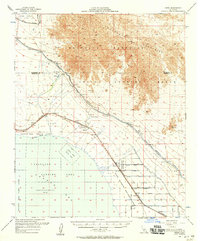
1956 Map of Frink
USGS Topo · Published 1958About this map
The Chocolate Mountains dominate the arid horizon of this mid-century survey, sloping down toward the eastern shore of the Salton Sea. The landscape is a study in desert reclamation and military utility, where the Coachella Canal and East Highline Canal provide vital water via a series of numbered siphons to support the desert settlements. Along the Southern Pacific tracks, small sidings and locales like Frink, Mundo, and Wister serve as focal points for local activity, including a Tropical Fish Farm and several Rock Quarry sites. The southern half of the map reveals the era's heavy military presence, with a designated Seaplane Landing Area and an Aerial Mine Laying Area within the waters, while the Wister Waterfowl Management Area indicates early conservation efforts along the retreating shoreline of the Salton Sea State Park.
Find a feature on this map
50 named features on this map. Tap any name to fly to it.
Don’t see what you’re looking for? This feature index may not catch every label — zoom into the map to look around manually.
Map Details
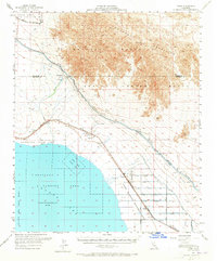
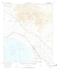
Editions of this 1956 Frink Map
3 editions found
Other maps of this area

1940 · Kane Spring
USGS Topo · 1:62,500

1940 · Iris
USGS Topo · 1:62,500

1940 · Frink
USGS Topo · 1:62,500

1940 · Cottonwood Spring
USGS Topo · 1:62,500

1940 · Iris Pass
USGS Topo · 1:62,500

1940 · Canyon Spring
USGS Topo · 1:62,500

1940 · Durmid
USGS Topo · 1:62,500

1943 · Canyon Spring
USGS Topo · 1:62,500

1944 · Cottonwood Spring
USGS Topo · 1:62,500

1944 · Durmid
USGS Topo · 1:62,500