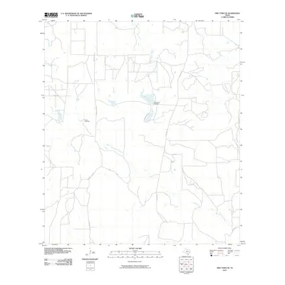
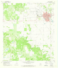
2010 Map of Frio Town NE
USGS Topo · Published 2010About this map
West Squirrel Creek and East Squirrel Creek converge in this rural expanse of Medina County, forming a landscape defined by intermittent watercourses and land management structures. The geography is characterized by the presence of significant local water impoundments, most notably the Richardson Lake Dam and the Farley Lake Dam, which signify the importance of water storage in this part of South Texas. These dams, along with a network of local thoroughfares like Squirrel Creek Rd and Deer Creek Rd, illustrate the intersection of natural drainage and ranching or agricultural development. The winding paths of Seco Creek and Parkers Creek further mark the terrain, showing the drainage patterns that feed into the larger Squirrel Creek system during this period in the early twenty-first century.
Find a feature on this map
12 named features on this map. Tap any name to fly to it.
Don’t see what you’re looking for? This feature index may not catch every label — zoom into the map to look around manually.
Map Details
Editions of this 2010 Frio Town NE Map
This is the sole edition of this map. No revisions or reprints were ever made.
Other maps of this area

1928 · Frio Town
USGS Topo · 1:62,500

1954 · San Antonio
USGS Topo · 1:250,000

1956 · Sabinal
USGS Topo · 1:62,500

1956 · New Fountain
USGS Topo · 1:62,500

1957 · San Antonio
USGS Topo · 1:250,000
1964 · Wilson Ranch
USGS Topo · 1:24,000

1964 · Yancey
USGS Topo · 1:24,000
1970 · Irishman Hill
USGS Topo · 1:24,000
1970 · D'hanis
USGS Topo · 1:24,000
1970 · Hondo
USGS Topo · 1:24,000