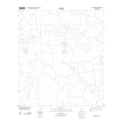
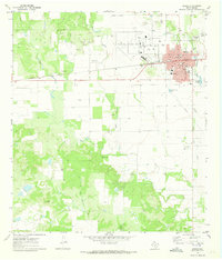
2012 Map of Frio Town NE
USGS Topo · Published 2012About this map
W Squirrel Cr and E Squirrel Cr define this ranching landscape in Medina County, coming together to form the main channel of Squirrel Cr as it flows south toward the Frio River basin. The area is characterized by a network of seasonal watercourses and private ranch roads, including Co RD-520 and Private Road 6100, which provide access to the dispersed operations in this corner of the Texas Hill Country. Small inland water bodies such as Richardson Lake and Farley Lake punctuate the arid terrain, serving as vital water sources for local livestock. This 2012 survey illustrates the enduring rural character of the region, where land use is dictated by the rugged drainage patterns of Seco Cr and its tributaries, reflecting a landscape that has changed little in its fundamental pastoral structure over the decades.
Find a feature on this map
12 named features on this map. Tap any name to fly to it.
Don’t see what you’re looking for? This feature index may not catch every label — zoom into the map to look around manually.
Map Details
Editions of this 2012 Frio Town NE Map
This is the sole edition of this map. No revisions or reprints were ever made.
Other maps of this area

1928 · Frio Town
USGS Topo · 1:62,500

1954 · San Antonio
USGS Topo · 1:250,000

1956 · Sabinal
USGS Topo · 1:62,500

1956 · New Fountain
USGS Topo · 1:62,500

1957 · San Antonio
USGS Topo · 1:250,000
1964 · Wilson Ranch
USGS Topo · 1:24,000

1964 · Yancey
USGS Topo · 1:24,000
1970 · Irishman Hill
USGS Topo · 1:24,000
1970 · D'hanis
USGS Topo · 1:24,000
1970 · Hondo
USGS Topo · 1:24,000