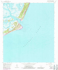
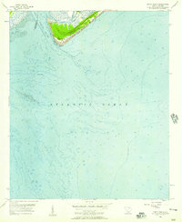
1958 Map of Fripps Inlet
USGS Topo · Published 1987About this map
Hunting Island State Park dominates this coastal survey, where the shifting sands of the Atlantic Ocean meet the intricate tidal networks of South Carolina's Lowcountry. The map illustrates a dynamic shoreline shaped by Fripps Inlet, showing the relationship between Hunting Island and the developing Fripps Island. Inland, the landscape is defined by a maze of waterways including the Story River, Johnson Creek, and Old House Creek, which wrap around secluded landmasses like Old Island and Bogs Island.
Find a feature on this map
13 named features on this map. Tap any name to fly to it.
Don’t see what you’re looking for? This feature index may not catch every label — zoom into the map to look around manually.
Map Details
Editions of this 1958 Fripps Inlet Map
4 editions found
Other maps of this area

1920 · St. Helena Sound
USGS Topo · 1:62,500

1920 · Hilton Head
USGS Topo · 1:62,500

1944 · Fort Fremont
USGS Topo · 1:62,500

1945 · Hilton Head
USGS Topo · 1:62,500

1947 · Savannah
USGS Topo · 1:250,000

1948 · St. Helena Sound
USGS Topo · 1:62,500

1948 · Savannah
USGS Topo · 1:250,000

1956 · Frogmore
USGS Topo · 1:24,000
1956 · Edisto Beach
USGS Topo · 1:24,000
1956 · St. Helena Sound
USGS Topo · 1:24,000