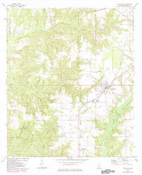
1972 Map of Frisco City
USGS Topo · Published 1984About this map
Frisco City serves as the central hub of this Monroe County landscape, defined by its position along the Burlington Northern railroad. The town's grid and central business district contrast with the surrounding rural character, where small communities like Megargel, Manistee, and Mexboro are linked by a network of local roads. The social fabric of the era is clearly visible through a high density of country churches and family burial grounds, including Bright Morning Star Ch, Shiloh Ch, and the Baas Cem. This 1970s survey, updated with 1980s aerial data, documents a landscape shaped by water and timber, with Bear Creek and Big Escambia Creek carving through the terrain. Evidence of local industry appears at the Gravel Pit near Randons Creek, while the presence of Middle Sch in the heart of the main settlement underscores the area's role as a regional center for education and commerce.
Find a feature on this map
24 named features on this map. Tap any name to fly to it.
Don’t see what you’re looking for? This feature index may not catch every label — zoom into the map to look around manually.
Map Details
Editions of this 1972 Frisco City Map
3 editions found
Other maps of this area

1953 · Andalusia
USGS Topo · 1:250,000

1957 · Andalusia
USGS Topo · 1:250,000

1972 · Monroeville
USGS Topo · 1:24,000

1972 · Frisco City
USGS Topo · 1:24,000

1972 · Frisco City SE
USGS Topo · 1:24,000

1972 · Uriah East
USGS Topo · 1:24,000

1972 · Excel
USGS Topo · 1:24,000

1972 · Mexia
USGS Topo · 1:24,000

1972 · Uriah West
USGS Topo · 1:24,000

1972 · Flynns Lake
USGS Topo · 1:24,000