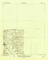
1929 Map of Frisco
USGS Topo · Published 1949About this map
The Elm Fork Trinity River snakes through the western half of this 1920s survey, defining a landscape of riparian bottomlands and rising prairie before much of the region's modern suburban development. Near Lewisville, the rail infrastructure is particularly prominent, featuring the Missouri Kansas and Texas RR and the Dallas Denton and Texas Electric Co interurban line. This area shows a high density of rural educational landmarks, including Hackberry Sch, Lake Sch, and Willow Spring Sch, reflecting the distributed agricultural community of the era.
Find a feature on this map
23 named features on this map. Tap any name to fly to it.
Don’t see what you’re looking for? This feature index may not catch every label — zoom into the map to look around manually.
Map Details
Editions of this 1929 Frisco Map
2 editions found
Other maps of this area

1891 · Dallas
USGS Topo · 1:125,000

1893 · Dallas
USGS Topo · 1:125,000

1894 · Fort Worth
USGS Topo · 1:125,000

1925 · Mc Kinney 3-c
USGS Topo · 1:48,000

1925 · Dallas 2-b
USGS Topo · 1:48,000

1929 · Frisco
USGS Topo · 1:62,500

1929 · McKinney
USGS Topo · 1:62,500

1931 · Carrollton
USGS Topo · 1:62,500

1931 · Grapevine
USGS Topo · 1:62,500

1954 · Dallas
USGS Topo · 1:250,000