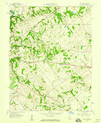
1958 Map of Fritchton
USGS Topo · Published 1960About this map
The eastern edges of Vincennes and the rural communities of Knox County are the focus of this late-1950s survey. The landscape is structured by two major rail lines, the Pennsylvania and the Baltimore and Ohio, which cut across a terrain defined by the drainage of Smalls Creek and the Deshee River. These corridors supported a network of country churches and small rural centers, including Fritchton and Verne, while the presence of an inactive Mine and several Tailings piles north of Pond Creek suggest a legacy of local resource extraction. Social landmarks of the era are clearly marked, such as the Drive-in Theater near the heart of the quadrangle and significant institutional sites like St Vincents Orphanage and the County Farm. These features provide a clear record of the mid-century transition from agrarian life to the developing outskirts of the city.
Find a feature on this map
36 named features on this map. Tap any name to fly to it.
Don’t see what you’re looking for? This feature index may not catch every label — zoom into the map to look around manually.
Map Details
Editions of this 1958 Fritchton Map
2 editions found
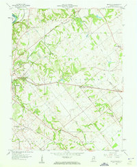
Other maps of this area

1915 · Vincennes
USGS Topo · 1:62,500

1917 · Birds
USGS Topo · 1:62,500

1942 · Fritchton
USGS Topo · 1:24,000

1942 · Birds
USGS Topo · 1:62,500

1943 · Oaktown
USGS Topo · 1:24,000

1943 · Bicknell
USGS Topo · 1:24,000

1944 · Fritchton
USGS Topo · 1:24,000

1944 · Monroe City
USGS Topo · 1:24,000

1944 · Wheatland
USGS Topo · 1:24,000

1944 · Iona
USGS Topo · 1:24,000