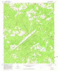
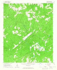
1964 Map of Frolona
USGS Topo · Published 1983About this map
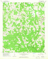
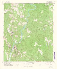
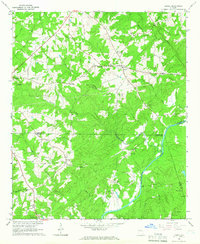
Backbone Ridge defines the topography of this Georgia landscape, anchored by the community of Frolona and a network of historic rural hubs including Yates Crossroads and Mahailey Crossroads. The map reveals a deeply settled agricultural region defined by its reliance on water courses like Hillabahatchee Creek and Town Creek, where numerous rural churches such as Macedonia Ch and Salem Ch served as the primary social anchors.
Find a feature on this map
40 named features on this map. Tap any name to fly to it.
Don’t see what you’re looking for? This feature index may not catch every label — zoom into the map to look around manually.
Map Details
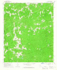
Editions of this 1964 Frolona Map
2 editions found
Other maps of this area

1899 · Wedowee
USGS Topo · 1:125,000

1902 · Wedowee
USGS Topo · 1:125,000

1953 · Atlanta
USGS Topo · 1:250,000

1957 · Atlanta
USGS Topo · 1:250,000

1958 · Atlanta
USGS Topo · 1:250,000
1964 · Glenn
USGS Topo · 1:24,000
1964 · Hillcrest
USGS Topo · 1:24,000
1964 · Roopville
USGS Topo · 1:24,000
1964 · Franklin
USGS Topo · 1:24,000
1964 · Lowell
USGS Topo · 1:24,000