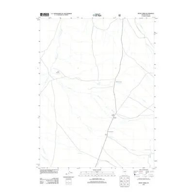
2012 Map of Frost Creek
USGS Topo · Published 2012About this map
High-desert ranching operations define the landscape of Elko County as shown in this recent survey. Named family holdings like Sestanovich Ranch and the Max Arnhold Ranch are situated along the primary north-south roadway, illustrating the persistent importance of water access in this arid basin. A network of ephemeral and perennial water sources, including Huntington Cr, Frost Cr, and Pearl Cr, originate from the higher elevations to the east, feeding the grazing lands below.
Find a feature on this map
22 named features on this map. Tap any name to fly to it.
Don’t see what you’re looking for? This feature index may not catch every label — zoom into the map to look around manually.
Map Details
Editions of this 2012 Frost Creek Map
This is the sole edition of this map. No revisions or reprints were ever made.
Other maps of this area

1934 · Jiggs
USGS Topo · 1:125,000

1937 · Jiggs
USGS Topo · 1:125,000

1955 · Elko
USGS Topo · 1:250,000

1956 · Robinson Mtn
USGS Topo · 1:62,500

1958 · Elko
USGS Topo · 1:250,000

1959 · Jiggs
USGS Topo · 1:62,500

1959 · Railroad Pass
USGS Topo · 1:62,500

1959 · Sherman Mtn
USGS Topo · 1:62,500

1962 · Elko
USGS Topo · 1:250,000

1965 · Elko
USGS Topo · 1:250,000