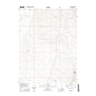
2015 Map of Frost Creek
USGS Topo · Published 2015About this map
Huntington Valley serves as the focal point for this Nevada landscape, where the high-desert terrain is defined by a network of drainage systems and vital water sources. The map details a transition from the lower valley floor into the rising elevations of the Humboldt National Forest at its eastern edge. Cattle ranching and land management are evident through the naming of the Corta Ranch Rd and the identification of essential water points like Frost Springs, Platt Spring, and Humboldt Spring. Transport through the area relies on historic corridors such as Old Harrison Pass Rd and various county and Forest Service roads. Named watercourses including Pearl Cr, Robinson Cr, and Lindsay Cr illustrate the complex watershed that flows from the adjacent mountains toward the valley bottom, sustaining the sparse vegetation and ranching operations of this Elko County region.
Find a feature on this map
30 named features on this map. Tap any name to fly to it.
Don’t see what you’re looking for? This feature index may not catch every label — zoom into the map to look around manually.
Map Details
Editions of this 2015 Frost Creek Map
This is the sole edition of this map. No revisions or reprints were ever made.
Other maps of this area

1934 · Jiggs
USGS Topo · 1:125,000

1937 · Jiggs
USGS Topo · 1:125,000

1955 · Elko
USGS Topo · 1:250,000

1956 · Robinson Mtn
USGS Topo · 1:62,500

1958 · Elko
USGS Topo · 1:250,000

1959 · Jiggs
USGS Topo · 1:62,500

1959 · Railroad Pass
USGS Topo · 1:62,500

1959 · Sherman Mtn
USGS Topo · 1:62,500

1962 · Elko
USGS Topo · 1:250,000

1965 · Elko
USGS Topo · 1:250,000