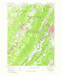
1951 Map of Frostburg
USGS Topo · Published 1966About this map
Frostburg and the surrounding mining corridor of Georges Creek anchor this mid-century look at the Maryland coalfields. The landscape is defined by the sharp ridges of Savage Mountain and Dans Mountain, where industrial activity is woven into the terrain via the Cumberland and Pennsylvania RR and the Western Maryland RR. Key industrial sites like Borden Shaft and various strip mines appear alongside long-standing local landmarks such as Emmanuel Ch and the Beall Sch. To the north, the historic Mason and Dixon Line marks the border with Pennsylvania, while the eastern edge is dominated by the narrow gap at Narrows Park leading into Cumberland. From the smaller settlements of Lonaconing and Midland to the Mexico Farm Landing Field near the Potomac River, the map captures the transition from heavy rail-and-mine industry to modern infrastructure like the Cumberland Airport.
Find a feature on this map
179 named features on this map. Tap any name to fly to it.
Don’t see what you’re looking for? This feature index may not catch every label — zoom into the map to look around manually.
Map Details
Editions of this 1951 Frostburg Map
This is the sole edition of this map. No revisions or reprints were ever made.
Other maps of this area

1891 · Romney
USGS Topo · 1:125,000

1895 · Piedmont
USGS Topo · 1:125,000

1898 · Frostburg
USGS Topo · 1:62,500

1899 · Flintstone
USGS Topo · 1:62,500

1899 · Grantsville
USGS Topo · 1:62,500

1900 · Flintstone
USGS Topo · 1:62,500

1901 · Frostburg
USGS Topo · 1:62,500

1904 · Grantsville
USGS Topo · 1:62,500

1908 · Frostburg
USGS Topo · 1:62,500

1919 · Elk Garden
USGS Topo · 1:48,000