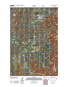
2011 Map of Fry Meadow
USGS Topo · Published 2011About this map
Lookout Mountain dominates the center of this high-elevation landscape in the Blue Mountains region of northeastern Oregon. The area is characterized by a series of high meadows and clearings used for seasonal livestock operations and forest management, including Fry Meadow, Brock Meadows, and Jarboe Meadow. Small-scale human imprints are scattered across the terrain, from the Jaus Saud Corral in the northwest to the Pearson Cabin at Kettleson Meadow.
Find a feature on this map
21 named features on this map. Tap any name to fly to it.
Don’t see what you’re looking for? This feature index may not catch every label — zoom into the map to look around manually.
Map Details
Editions of this 2011 Fry Meadow Map
This is the sole edition of this map. No revisions or reprints were ever made.
Other maps of this area

1955 · Grangeville
USGS Topo · 1:250,000

1959 · Grangeville
USGS Topo · 1:250,000

1964 · Partridge Creek
USGS Topo · 1:24,000

1964 · Howard Butte
USGS Topo · 1:24,000

1964 · Rondowa
USGS Topo · 1:24,000

1967 · Fry Meadow
USGS Topo · 1:24,000

1967 · Elbow Creek
USGS Topo · 1:24,000
1967 · Bone Spring
USGS Topo · 1:24,000
1967 · Deep Creek
USGS Topo · 1:24,000
1967 · Wenaha Forks
USGS Topo · 1:24,000