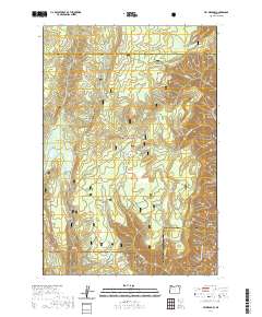
2020 Map of Fry Meadow
USGS Topo · Published 2020About this map
Umatilla National Forest and Wallowa National Forest converge in this high-altitude landscape of northeast Oregon, where the boundary between Wallowa and Union counties is defined by the steep drainage patterns of the Blue Mountains. The terrain is characterized by a series of significant clearings and grazing grounds, including Jarboe Meadow, Kettleson Meadow, and the namesake Fry Meadow. These natural openings are supported by a network of vital water sources such as Lookout Mountain Spring and Sheepherder Spring. The southeastern corner of the map reveals the dramatic descent into the Grande Ronde Wild and Scenic River corridor. This area reflects a long-standing land-use history focused on timber, seasonal grazing, and wilderness access, connected by the Jaussaud Creek Trail and remote forest routes like Nat For Dev Rd 511.
Find a feature on this map
32 named features on this map. Tap any name to fly to it.
Don’t see what you’re looking for? This feature index may not catch every label — zoom into the map to look around manually.
Map Details
Editions of this 2020 Fry Meadow Map
This is the sole edition of this map. No revisions or reprints were ever made.
Other maps of this area

1955 · Grangeville
USGS Topo · 1:250,000

1959 · Grangeville
USGS Topo · 1:250,000

1964 · Partridge Creek
USGS Topo · 1:24,000

1964 · Howard Butte
USGS Topo · 1:24,000

1964 · Rondowa
USGS Topo · 1:24,000

1967 · Fry Meadow
USGS Topo · 1:24,000

1967 · Elbow Creek
USGS Topo · 1:24,000
1967 · Bone Spring
USGS Topo · 1:24,000
1967 · Deep Creek
USGS Topo · 1:24,000
1967 · Wenaha Forks
USGS Topo · 1:24,000