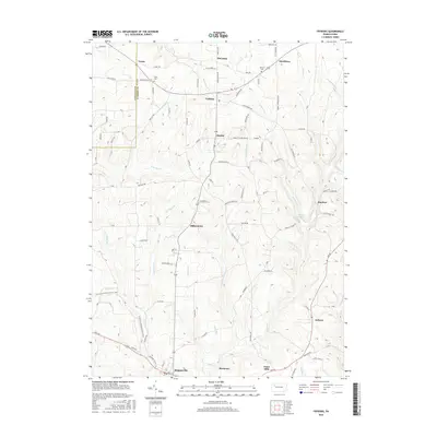
2016 Map of Fryburg
USGS Topo · Published 2016About this map
The Venango County and Clarion County line divides this landscape of high plateaus and winding stream valleys. Small settlements like Fryburg and Marble serve as central points in a rural network of roads and family-named landmarks. Genealogists can identify key burial sites including Venus Cemetery near the community of Venus and Dehner Cemetery further east toward Strobleton. To the south, the terrain descends toward Shippenville and Marianne, where Paint Creek and Stony Run carve through the topography. Modern recreational use is represented by the North Country National Scenic Trail, which winds through the western half of the map, crossing Deer Creek and passing through the hills west of Millerstown. The map also captures several smaller locales like Huefner, Paint Mills, and Arthurs that reflect the dispersed settlement pattern of this part of Pennsylvania.
Find a feature on this map
118 named features on this map. Tap any name to fly to it.
Don’t see what you’re looking for? This feature index may not catch every label — zoom into the map to look around manually.
Map Details
Editions of this 2016 Fryburg Map
This is the sole edition of this map. No revisions or reprints were ever made.
Other maps of this area

1906 · Clarion
USGS Topo · 1:62,500

1907 · Clarion
USGS Topo · 1:62,500

1907 · Foxburg
USGS Topo · 1:62,500

1908 · Foxburg
USGS Topo · 1:62,500

1922 · Oil City
USGS Topo · 1:48,000

1922 · Tionesta
USGS Topo · 1:62,500

1924 · Oil City
USGS Topo · 1:62,500

1924 · Tionesta
USGS Topo · 1:62,500

1943 · Oil City
USGS Topo · 1:62,500

1946 · Tionesta
USGS Topo · 1:62,500