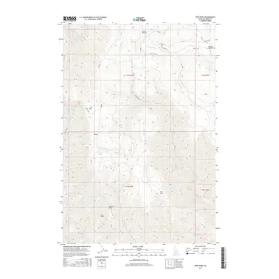
2017 Map of Frye Point
USGS Topo · Published 2017About this map
Craig Mtn anchors this section of Nez Perce County, defining a landscape marked by dramatic elevation changes and a dense network of drainage systems. The small settlement at Zaza serves as a lone reference point in an area dominated by prominent ridges and deep gulches. The drainage patterns are particularly intricate, with Captain John Cr and Eagle Cr carving through the terrain alongside numerous named tributaries like China Garden Cr and Fourth Cr. These waterways hint at the historical navigation of the canyons and the early importance of water sources in the high country.
Find a feature on this map
32 named features on this map. Tap any name to fly to it.
Don’t see what you’re looking for? This feature index may not catch every label — zoom into the map to look around manually.
Map Details
Editions of this 2017 Frye Point Map
This is the sole edition of this map. No revisions or reprints were ever made.
Other maps of this area

1946 · Limekiln Rapids
USGS Topo · 1:62,500

1955 · Pullman
USGS Topo · 1:250,000

1955 · Grangeville
USGS Topo · 1:250,000

1958 · Pullman
USGS Topo · 1:250,000

1959 · Grangeville
USGS Topo · 1:250,000

1963 · Jim Creek Butte
USGS Topo · 1:24,000

1963 · Rattlesnake Ridge
USGS Topo · 1:24,000

1963 · Wapshilla Creek
USGS Topo · 1:24,000

1967 · Hoover Point
USGS Topo · 1:24,000

1968 · Waha
USGS Topo · 1:24,000