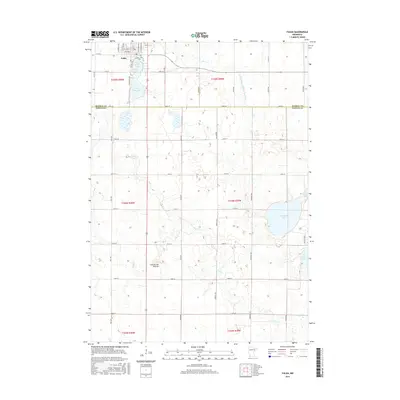
2016 Map of Fulda
USGS Topo · Published 2016About this map
Fulda anchors the northern portion of this landscape, situated at the edge of the Coteau des Prairies, a high glacial plateau that rises above the surrounding plains. The town is defined by its immediate proximity to Fulda First Lake and Fulda Second Lake, which serve as prominent geographical markers for the community. The surrounding terrain transitions into Nobles County to the south, characterized by an organized grid of county roads and avenues such as Paul Ave and Sunderberg Ave.
Find a feature on this map
41 named features on this map. Tap any name to fly to it.
Don’t see what you’re looking for? This feature index may not catch every label — zoom into the map to look around manually.
Map Details
Editions of this 2016 Fulda Map
This is the sole edition of this map. No revisions or reprints were ever made.
Other maps of this area

1954 · Fairmont
USGS Topo · 1:250,000

1958 · Fairmont
USGS Topo · 1:250,000

1960 · Brewster
USGS Topo · 1:24,000

1960 · Reading
USGS Topo · 1:24,000

1960 · Worthington North
USGS Topo · 1:24,000

1970 · Heron Lake NW
USGS Topo · 1:24,000

1970 · Dundee
USGS Topo · 1:24,000

1970 · Fulda
USGS Topo · 1:24,000
1970 · Fulda SW
USGS Topo · 1:24,000
1970 · Lime Creek
USGS Topo · 1:24,000