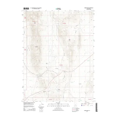
2014 Map of Furner Ridge
USGS Topo · Published 2014About this map
East Tintic Mountains dominate the western portion of this topographic survey, descending into a series of valleys and basins characterized by seasonal water management. The landscape is defined by the prominent Furner Ridge and the Furner Pass which provides passage through the high ground. Water resources are primarily captured in small, named catchments such as Dog Valley Reservoir, Hole in Rock Reservoir, and Brough Reservoir. These features, along with Tidwell Spring, underscore the necessity of water control in this arid environment. The map details an extensive network of backroads and trails including Old Jericho Rd and Sage Valley Rd, which navigate through Furner Valley and the depression known as The Holes. This layout reflects a remote region largely dedicated to open range and limited resource extraction.
Find a feature on this map
32 named features on this map. Tap any name to fly to it.
Don’t see what you’re looking for? This feature index may not catch every label — zoom into the map to look around manually.
Map Details
Editions of this 2014 Furner Ridge Map
This is the sole edition of this map. No revisions or reprints were ever made.
Other maps of this area

1885 · Manti
USGS Topo · 1:250,000

1885 · Sevier Desert
USGS Topo · 1:250,000

1895 · Manti
USGS Topo · 1:250,000

1951 · Santaquin
USGS Topo · 1:62,500

1951 · Nephi
USGS Topo · 1:62,500

1953 · Delta
USGS Topo · 1:250,000

1954 · Mc Intyre
USGS Topo · 1:24,000

1954 · Tintic Mountain
USGS Topo · 1:24,000

1956 · Price
USGS Topo · 1:250,000

1958 · Delta
USGS Topo · 1:250,000