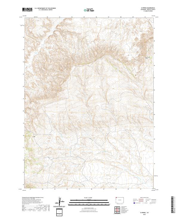
2022 Map of G Spring
USGS Topo · Published 2022About this map
G Spring is a vital water source in this arid corner of Moffat County, providing a rare point of reliability in a landscape defined by seasonal drainage. The terrain is dominated by the steep rises of the Vermillion Bluffs in the northeast and the passage through G Gap further west. These natural features dictate the path of travel through the region, where Co Rd 52 and Co Rd 46 navigate the high desert floor. The map traces the winding courses of Sand Wash and Dry Cr, ephemeral waterways that carve through the sedimentary layers of the basin. This survey documents the intersection of essential ranching infrastructure and the challenging geography of the Colorado backcountry in the early twenty-first century.
Find a feature on this map
13 named features on this map. Tap any name to fly to it.
Don’t see what you’re looking for? This feature index may not catch every label — zoom into the map to look around manually.
Map Details
Editions of this 2022 G Spring Map
This is the sole edition of this map. No revisions or reprints were ever made.
Other maps of this area

1954 · Vernal
USGS Topo · 1:250,000

1958 · Vernal
USGS Topo · 1:250,000

1960 · Vernal
USGS Topo · 1:250,000

1960 · Lone Mountain
USGS Topo · 1:62,500

1966 · G Spring
USGS Topo · 1:24,000

1966 · Sugarloaf Butte
USGS Topo · 1:24,000

1966 · Irish Canyon
USGS Topo · 1:24,000

1966 · Sheephead Basin
USGS Topo · 1:24,000

1966 · Hiawatha
USGS Topo · 1:24,000
1966 · Vermillion Mesa
USGS Topo · 1:24,000