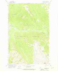
1958 Map of Gable Peaks
USGS Topo · Published 1975About this map
Flathead National Forest defines the geography of this mid-century survey, centered on the confluence of the Middle Fork Flathead River and its major tributaries. The presence of the Schafer Ranger Sta and an adjacent Landing Strip at Schafer Meadows indicates the remote administrative infrastructure required to manage these highlands. The landscape is a high-altitude network of drainage systems, including Dolly Varden Creek and Calbick Creek, that cut through prominent summits like Gable Peaks and Chair Mountain. This 1958 field check documents a primitive transportation network consisting of the Big River Trail and several Pack Trails, showing how the region remained accessible only by foot, hoof, or small aircraft during this period.
Find a feature on this map
23 named features on this map. Tap any name to fly to it.
Don’t see what you’re looking for? This feature index may not catch every label — zoom into the map to look around manually.
Map Details
Editions of this 1958 Gable Peaks Map
2 editions found
Other maps of this area

1913 · Marias Pass
USGS Topo · 1:125,000

1936 · Silvertip
USGS Topo · 1:96,000

1942 · Silvertip
USGS Topo · 1:125,000

1955 · Choteau
USGS Topo · 1:250,000

1957 · Choteau
USGS Topo · 1:250,000

1958 · Choteau
USGS Topo · 1:250,000

1958 · Red Plume Mountain
USGS Topo · 1:24,000

1958 · Gable Peaks
USGS Topo · 1:24,000

1958 · Capitol Mountain
USGS Topo · 1:24,000

1958 · Crescent Cliff
USGS Topo · 1:24,000