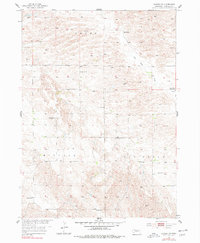
1954 Map of Gables SW
USGS Topo · Published 1978About this map
HO Ranch sits in the northern reaches of this Garfield County landscape, an area defined by its early 1950s ranching and educational infrastructure. The territory is organized into the Bryan, Midvale, and Dry Cedar districts, each containing a network of rural schoolhouses that served the dispersed homesteads of the Sandhills region. The map reveals a high density of these local landmarks, including School No 19, School No 24, and School No 17. The presence of School No 11 (Abandoned) by the mid-century point indicates a shifting population during the postwar era. Water management is central to life here, evidenced by numerous Windmill sites located along the winding path of Dry Cedar Creek, which provided essential resources for livestock in this Nebraska interior.
Find a feature on this map
13 named features on this map. Tap any name to fly to it.
Don’t see what you’re looking for? This feature index may not catch every label — zoom into the map to look around manually.
Map Details
Editions of this 1954 Gables SW Map
3 editions found
Other maps of this area

1952 · Elyria
USGS Topo · 1:24,000

1952 · Burwell SE
USGS Topo · 1:24,000

1952 · Burwell NE
USGS Topo · 1:24,000

1954 · Gables SE
USGS Topo · 1:24,000

1954 · Gables SW
USGS Topo · 1:24,000

1954 · Ord NE
USGS Topo · 1:24,000

1954 · Ord NW
USGS Topo · 1:24,000

1954 · Gables NW
USGS Topo · 1:24,000

1954 · Gables
USGS Topo · 1:24,000

1955 · Broken Bow
USGS Topo · 1:250,000