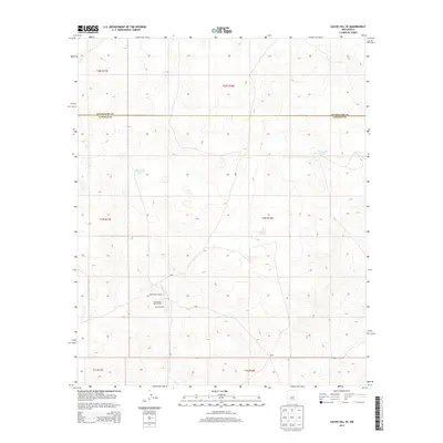
2013 Map of Gacho Hill SE
USGS Topo · Published 2013About this map
The Guadalupe Co Lincoln Co boundary line bisects this high-plains landscape, where the geography is defined more by ranching infrastructure and water catchments than by dense settlement. In the southern portion of the quadrangle, Sanders Ranch and the related Roadrunner Ranch and Roadrunner Ranch North mark the active human presence in this region of Lincoln County. These ranching outposts are connected by a network of local forest or ranch roads, such as f027 and f034. Water management is central to the land's utility, evidenced by the presence of Manzanita Lake and several named catchments including Manzanita Tank and Bono Tank. The map illustrates the sprawling Public Land Survey System divisions, spanning from T2n R17e down to T1s R18e, providing a clear record of how these vast western parcels were organized for grazing and development.
Find a feature on this map
15 named features on this map. Tap any name to fly to it.
Don’t see what you’re looking for? This feature index may not catch every label — zoom into the map to look around manually.
Map Details
Editions of this 2013 Gacho Hill SE Map
This is the sole edition of this map. No revisions or reprints were ever made.
Other maps of this area

1954 · Fort Sumner
USGS Topo · 1:250,000

1958 · Fort Sumner
USGS Topo · 1:250,000

1967 · Ramon
USGS Topo · 1:24,000

1979 · Fort Sumner
USGS Topo · 1:100,000

1980 · Corona
USGS Topo · 1:100,000

1981 · Loco Draw
USGS Topo · 1:24,000

1981 · Cowboy Mesa NE
USGS Topo · 1:24,000

1981 · Gacho Hill NW
USGS Topo · 1:24,000

1981 · Gacho Hill SW
USGS Topo · 1:24,000

1981 · Gacho Hill SE
USGS Topo · 1:24,000