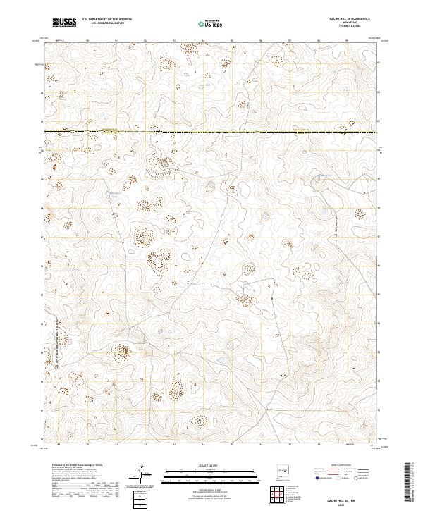
2023 Map of Gacho Hill SE
USGS Topo · Published 2023About this map
The high plains of the Guadalupe Co Lincoln Co boundary define this landscape of water-scarcity management in central New Mexico. The survey reveals a terrain primarily shaped by seasonal hydrology and ranching infrastructure, where water sources like Manzanita Lake and Manzanita Tank serve as critical landmarks. Transport across the arid landscape is primarily facilitated by the north-south passage of Co Rd 3l, which cuts through the township grids of t2n r18e and t1n r18e. This 2023 edition documents the essential water catchments, including Bano Tank, that support the region's agricultural use and land management patterns. The placement of these features relative to the county line provides clear spatial context for local property and infrastructure research.
Find a feature on this map
11 named features on this map. Tap any name to fly to it.
Don’t see what you’re looking for? This feature index may not catch every label — zoom into the map to look around manually.
Map Details
Editions of this 2023 Gacho Hill SE Map
This is the sole edition of this map. No revisions or reprints were ever made.
Other maps of this area

1954 · Fort Sumner
USGS Topo · 1:250,000

1958 · Fort Sumner
USGS Topo · 1:250,000

1967 · Ramon
USGS Topo · 1:24,000

1979 · Fort Sumner
USGS Topo · 1:100,000

1980 · Corona
USGS Topo · 1:100,000

1981 · Loco Draw
USGS Topo · 1:24,000

1981 · Cowboy Mesa NE
USGS Topo · 1:24,000

1981 · Gacho Hill NW
USGS Topo · 1:24,000

1981 · Gacho Hill SW
USGS Topo · 1:24,000

1981 · Gacho Hill SE
USGS Topo · 1:24,000