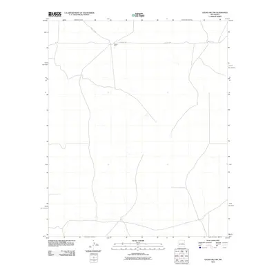
2010 Map of Gacho Hill SW
USGS Topo · Published 2010About this map
Burgette Ranch stands as a primary landmark in this section of the New Mexico plains, where the landscape is defined by vast open spaces and ephemeral drainage patterns. This 2010 survey illustrates a quiet rural expanse where human presence is concentrated along a singular corridor of transportation. Running across the northern portion of the quadrangle, County Rd-3ka provides the essential link through this portion of Lincoln County, connecting isolated ranching operations to the wider region. The map reveals a high-desert environment where intermittent stream beds and subtle topographic shifts dictate the layout of roads and homesteads, offering a clear record of land use and ranching life in the early 21st century.
Find a feature on this map
2 named features on this map. Tap any name to fly to it.
Don’t see what you’re looking for? This feature index may not catch every label — zoom into the map to look around manually.
Map Details
Editions of this 2010 Gacho Hill SW Map
This is the sole edition of this map. No revisions or reprints were ever made.
Other maps of this area

1954 · Fort Sumner
USGS Topo · 1:250,000

1958 · Fort Sumner
USGS Topo · 1:250,000

1980 · Corona
USGS Topo · 1:100,000

1981 · Cowboy Mesa NE
USGS Topo · 1:24,000

1981 · Gacho Hill NW
USGS Topo · 1:24,000

1981 · Gacho Hill SW
USGS Topo · 1:24,000

1981 · Camaleon Draw East
USGS Topo · 1:24,000

1981 · Gacho Hill SE
USGS Topo · 1:24,000
1981 · Duran NE
USGS Topo · 1:24,000
1981 · Gacho Hill
USGS Topo · 1:24,000