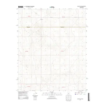
2013 Map of Gacho Hill SW
USGS Topo · Published 2013About this map
Burette Ranch stands as the primary namesake landmark in this high-desert landscape, situated in the northern reaches of Lincoln County near the boundary line with Guadalupe County. The area is defined by the high-elevation terrain of central New Mexico, where the remote Co Road 3KA provides one of the few established routes across the open ranch lands. This 2013 survey illustrates a sparsely populated region where the cattle industry and vast grazing tracts remain the dominant feature of the economy. The map provides a detailed view of the township and range divisions, documenting the spatial organization of the Guadalupe Co Lincoln Co border as it cuts across the undulating topography of the Gacho Hill SW quadrangle.
Find a feature on this map
9 named features on this map. Tap any name to fly to it.
Don’t see what you’re looking for? This feature index may not catch every label — zoom into the map to look around manually.
Map Details
Editions of this 2013 Gacho Hill SW Map
This is the sole edition of this map. No revisions or reprints were ever made.
Other maps of this area

1954 · Fort Sumner
USGS Topo · 1:250,000

1958 · Fort Sumner
USGS Topo · 1:250,000

1980 · Corona
USGS Topo · 1:100,000

1981 · Cowboy Mesa NE
USGS Topo · 1:24,000

1981 · Gacho Hill NW
USGS Topo · 1:24,000

1981 · Gacho Hill SW
USGS Topo · 1:24,000

1981 · Camaleon Draw East
USGS Topo · 1:24,000

1981 · Gacho Hill SE
USGS Topo · 1:24,000
1981 · Duran NE
USGS Topo · 1:24,000
1981 · Gacho Hill
USGS Topo · 1:24,000