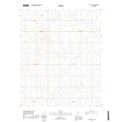
2020 Map of Gacho Hill SW
USGS Topo · Published 2020About this map
The county line between Guadalupe Co and Lincoln Co bisects this high plains landscape in east-central New Mexico. This 2020 edition reveals a sparse and open topography, primarily defined by complex contour patterns and the occasional transit route through the arid terrain. Infrastructure is limited to the northern reaches of the quadrangle, where Jacklope Rd and Co Rd 3ka provide the primary access points across the section lines. The map serves as a clear record of the Public Land Survey System divisions, meticulously marking townships and ranges including t2n r16e and t1n r17e. It is an essential document for understanding land ownership patterns and the vast, undeveloped character of the region as it exists in the 21st century.
Find a feature on this map
9 named features on this map. Tap any name to fly to it.
Don’t see what you’re looking for? This feature index may not catch every label — zoom into the map to look around manually.
Map Details
Editions of this 2020 Gacho Hill SW Map
This is the sole edition of this map. No revisions or reprints were ever made.
Other maps of this area

1954 · Fort Sumner
USGS Topo · 1:250,000

1958 · Fort Sumner
USGS Topo · 1:250,000

1980 · Corona
USGS Topo · 1:100,000

1981 · Cowboy Mesa NE
USGS Topo · 1:24,000

1981 · Gacho Hill NW
USGS Topo · 1:24,000

1981 · Gacho Hill SW
USGS Topo · 1:24,000

1981 · Camaleon Draw East
USGS Topo · 1:24,000

1981 · Gacho Hill SE
USGS Topo · 1:24,000
1981 · Duran NE
USGS Topo · 1:24,000
1981 · Gacho Hill
USGS Topo · 1:24,000