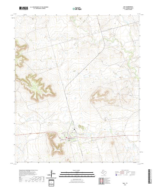
2022 Map of Gail
USGS Topo · Published 2022About this map
Gail stands as the primary settlement and county seat in this West Texas landscape, dominated by the prominent rise of Gail Mtn just to the southwest. The town is situated at a crossroads of ranch roads and local highways, where Town Draw and Mesquite Cr meet the flat land below the Caprock. The map provides a clear look at the local civic core, including the Borden County Courthouse and the nearby Gail Cem, which serve as vital touchstones for family historians researching this sparsely populated cattle country.
Find a feature on this map
25 named features on this map. Tap any name to fly to it.
Don’t see what you’re looking for? This feature index may not catch every label — zoom into the map to look around manually.
Map Details
Editions of this 2022 Gail Map
This is the sole edition of this map. No revisions or reprints were ever made.
Other maps of this area

1954 · Big Spring
USGS Topo · 1:250,000

1958 · Big Spring
USGS Topo · 1:250,000

1969 · Gail NE
USGS Topo · 1:24,000

1969 · Beal Hollow
USGS Topo · 1:24,000

1969 · Indian Canyon NE
USGS Topo · 1:24,000

1969 · Gail
USGS Topo · 1:24,000

1969 · Holloway Canyon
USGS Topo · 1:24,000
1969 · Fivemile Creek
USGS Topo · 1:24,000

1970 · Mushaway Peak
USGS Topo · 1:24,000
1970 · Gunsight Draw NE
USGS Topo · 1:24,000