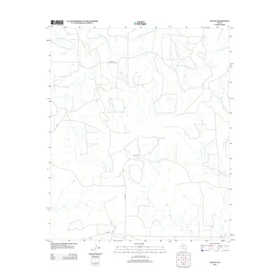
2012 Map of Gail NE
USGS Topo · Published 2012About this map
Double Mountain Fork Brazos River cuts through the northern landscape of Garza County, marking a terrain defined by its complex network of drainage creeks. This rural expanse, captured as it appeared in 2012, centers on the prominent Miller Ranch, accessible by a network of ranch roads including R Miller Rd. The map illustrates a highly localized water system where numerous seasonal tributaries like Sand Cr, Gavett Cr, and Gopher Cr feed into the larger river basin. Local transportation is facilitated by several Farm to Market roads such as FM-2350 and FM-612, which connect the scattered agricultural holdings and ranchlands of this Texas plains region. The absence of dense townships highlights the area's enduring character as a sparsely populated cattle and ranching territory.
Find a feature on this map
16 named features on this map. Tap any name to fly to it.
Don’t see what you’re looking for? This feature index may not catch every label — zoom into the map to look around manually.
Map Details
Editions of this 2012 Gail NE Map
This is the sole edition of this map. No revisions or reprints were ever made.
Other maps of this area

1954 · Lubbock
USGS Topo · 1:250,000

1954 · Big Spring
USGS Topo · 1:250,000

1958 · Big Spring
USGS Topo · 1:250,000

1969 · Gail NE
USGS Topo · 1:24,000

1969 · Arah
USGS Topo · 1:24,000

1969 · Beal Hollow
USGS Topo · 1:24,000

1969 · Fluvanna
USGS Topo · 1:24,000

1969 · Gail
USGS Topo · 1:24,000

1969 · Justiceburg
USGS Topo · 1:24,000

1969 · Cooper Creek
USGS Topo · 1:24,000