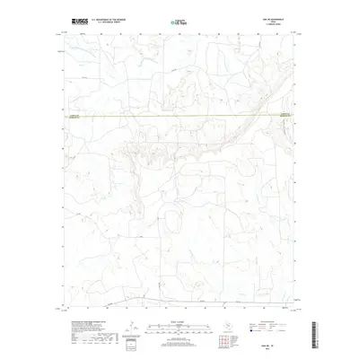
2019 Map of Gail NE
USGS Topo · Published 2019About this map
The Double Mountain Fork Brazos River winds through the northwestern corner of this landscape, marking a significant hydrologic feature along the boundary of the High Plains. This territory is defined by the escarpment and breaks of the Caprock, where the terrain drops into complex drainage systems including Red Canyon and Griffin Cr. The transition from the flat plateau above to the dissected canyons below is evident in the sharp contouring around the various forks of Gavett Cr and E Gavett Cr.
Find a feature on this map
16 named features on this map. Tap any name to fly to it.
Don’t see what you’re looking for? This feature index may not catch every label — zoom into the map to look around manually.
Map Details
Editions of this 2019 Gail NE Map
This is the sole edition of this map. No revisions or reprints were ever made.
Other maps of this area

1954 · Lubbock
USGS Topo · 1:250,000

1954 · Big Spring
USGS Topo · 1:250,000

1958 · Big Spring
USGS Topo · 1:250,000

1969 · Gail NE
USGS Topo · 1:24,000

1969 · Arah
USGS Topo · 1:24,000

1969 · Beal Hollow
USGS Topo · 1:24,000

1969 · Fluvanna
USGS Topo · 1:24,000

1969 · Gail
USGS Topo · 1:24,000

1969 · Justiceburg
USGS Topo · 1:24,000

1969 · Cooper Creek
USGS Topo · 1:24,000