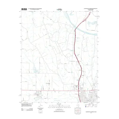
2013 Map of Gainesville North
USGS Topo · Published 2013About this map
Lindsay and the northern outskirts of Gainesville define this landscape along the border of Texas and Oklahoma, where the Red River snakes across the northern portion of the quadrangle. The 2013 survey illustrates a region shaped by its watercourses and transportation hubs, including the Gainesville Municipal Airport and the historic Santa Fe Passenger Depot. Several smaller water bodies, such as Leeper Lake and North Club Lake, dot the terrain alongside tributaries like Dozier Cr and Montague Cr that feed into the Elm Fork Trinity River. Cultural and local history is anchored by sites like the Red River Cem near the riverbank and the Rest Haven Memorial Cem further south. The map reflects a blend of rural land use, established aviation infrastructure, and the persistent presence of the river as a natural boundary and geographical focal point.
Find a feature on this map
98 named features on this map. Tap any name to fly to it.
Don’t see what you’re looking for? This feature index may not catch every label — zoom into the map to look around manually.
Map Details
Editions of this 2013 Gainesville North Map
This is the sole edition of this map. No revisions or reprints were ever made.
Other maps of this area

1902 · Gainesville
USGS Topo · 1:125,000

1943 · Gainesville
USGS Topo · 1:125,000

1954 · Sherman
USGS Topo · 1:250,000

1958 · Sherman
USGS Topo · 1:250,000

1960 · Callisburg
USGS Topo · 1:24,000

1960 · Gainesville South
USGS Topo · 1:24,000

1960 · Gainesville North
USGS Topo · 1:24,000

1960 · Woodbine
USGS Topo · 1:24,000

1961 · Hood
USGS Topo · 1:24,000

1961 · Muenster East
USGS Topo · 1:24,000