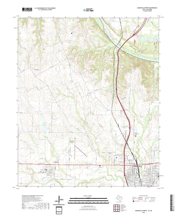
2022 Map of Gainesville North
USGS Topo · Published 2022About this map
The Red River defines the border between Cooke County, Texas and Love County, Oklahoma, carving a winding path north of Gainesville. This northern reach of the county shows a landscape transitioning from the river lowlands toward the elevation of Wolf Ridge in the west. The area's development is anchored by significant infrastructure, including the Gainesville Municipal Airport and the heavy corridor of I-35, which connects the region to points north across the state line.
Find a feature on this map
97 named features on this map. Tap any name to fly to it.
Don’t see what you’re looking for? This feature index may not catch every label — zoom into the map to look around manually.
Map Details
Editions of this 2022 Gainesville North Map
This is the sole edition of this map. No revisions or reprints were ever made.
Other maps of this area

1902 · Gainesville
USGS Topo · 1:125,000

1943 · Gainesville
USGS Topo · 1:125,000

1954 · Sherman
USGS Topo · 1:250,000

1958 · Sherman
USGS Topo · 1:250,000

1960 · Callisburg
USGS Topo · 1:24,000

1960 · Gainesville South
USGS Topo · 1:24,000

1960 · Gainesville North
USGS Topo · 1:24,000

1960 · Woodbine
USGS Topo · 1:24,000

1961 · Hood
USGS Topo · 1:24,000

1961 · Muenster East
USGS Topo · 1:24,000