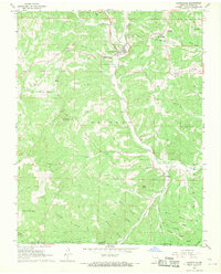
1968 Map of Gainesville
USGS Topo · Published 1970About this map
Gainesville serves as the focal point of this Ozark County landscape, situated at the confluence of Lick Creek and Harrison Creek. The settlement pattern follows the drainage of these waterways, with the Gainesville High Sch and Gainesville Memorial Airport marking the town's mid-century footprint. Small rural communities like Lilly and Mammoth are anchored by local landmarks such as Lilly Ridge Ch and Mammoth Cem.
Find a feature on this map
53 named features on this map. Tap any name to fly to it.
Don’t see what you’re looking for? This feature index may not catch every label — zoom into the map to look around manually.
Map Details
Editions of this 1968 Gainesville Map
3 editions found
Other maps of this area

1890 · Mountain Home
USGS Topo · 1:125,000

1891 · Mountain Home
USGS Topo · 1:125,000

1893 · Yellville
USGS Topo · 1:125,000

1894 · Mountain Home
USGS Topo · 1:125,000

1903 · Yellville
USGS Topo · 1:125,000

1905 · Yellville
USGS Topo · 1:125,000

1929 · Yellville
USGS Topo · 1:125,000

1934 · Gainesville
USGS Topo · 1:48,000

1936 · Thornfield
USGS Topo · 1:48,000

1940 · Gainesville
USGS Topo · 1:62,500