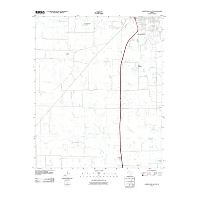
2010 Map of Gainesville South
USGS Topo · Published 2010About this map
The southern outskirts of Gainesville and the surrounding Cooke County countryside are defined by the winding course of the Elm Fork Trinity River and its numerous tributaries. This 2010 survey shows a landscape where residential expansion meets established agricultural and conservation projects, evidenced by the Soil Conservation Service Site 61q Dam and Sarles Lake. The area's hydrology is complex, with Pecan Creek, Scott Creek, and Hackle Creek carving through the terrain towards the larger river system.
Find a feature on this map
58 named features on this map. Tap any name to fly to it.
Don’t see what you’re looking for? This feature index may not catch every label — zoom into the map to look around manually.
Map Details
Editions of this 2010 Gainesville South Map
This is the sole edition of this map. No revisions or reprints were ever made.
Other maps of this area

1902 · Gainesville
USGS Topo · 1:125,000

1943 · Gainesville
USGS Topo · 1:125,000

1954 · Sherman
USGS Topo · 1:250,000

1958 · Sherman
USGS Topo · 1:250,000

1960 · Callisburg
USGS Topo · 1:24,000

1960 · Gainesville South
USGS Topo · 1:24,000

1960 · Gainesville North
USGS Topo · 1:24,000

1960 · Woodbine
USGS Topo · 1:24,000

1961 · Era
USGS Topo · 1:24,000

1961 · Hood
USGS Topo · 1:24,000