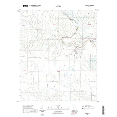
2018 Map of Gainesville
USGS Topo · Published 2018About this map
Gainesville occupies the high ground overlooking the convergence of the Noxubee River and the Tennessee-Tombigbee Waterway along the border of Sumter and Greene Counties. This 2018 survey documents the intricate riverine landscape, where numerous bars and bends like Chambers Bar and Nubbin Bend trace the historic flow of the water. The town site itself is detailed with street-level accuracy, showing the layout of Webster St and S Church St leading toward the riverfront.
Find a feature on this map
71 named features on this map. Tap any name to fly to it.
Don’t see what you’re looking for? This feature index may not catch every label — zoom into the map to look around manually.
Map Details
Editions of this 2018 Gainesville Map
This is the sole edition of this map. No revisions or reprints were ever made.
Other maps of this area

1929 · Epes
USGS Topo · 1:48,000

1932 · Epes
USGS Topo · 1:62,500

1953 · Meridian
USGS Topo · 1:250,000

1957 · Meridian
USGS Topo · 1:250,000

1965 · Meridian
USGS Topo · 1:250,000
1970 · West Greene
USGS Topo · 1:24,000
1970 · Boligee
USGS Topo · 1:24,000

1970 · Gainesville
USGS Topo · 1:24,000

1970 · Warsaw
USGS Topo · 1:24,000

1973 · Panola
USGS Topo · 1:24,000