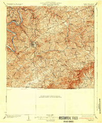
1933 Map of Galax
USGS Topo · Published 1933About this map
The New River winds through the northwestern corner of this 1930s survey, where the industrial town of Fries and the nearby Hilltown sit along the riverbanks. The Norfolk and Western railroad corridor follows Chestnut Creek southward, connecting the river to the growing hub of Galax and the smaller settlements of Cliffview and Chestnut Yard Monerat PO. This rail-and-creek orientation defines the local economy, as the topography transitions into the steep ridges of the Unaka Nat Forest and the Blue Ridge escarpment.
Find a feature on this map
104 named features on this map. Tap any name to fly to it.
Don’t see what you’re looking for? This feature index may not catch every label — zoom into the map to look around manually.
Map Details
Editions of this 1933 Galax Map
3 editions found

Other maps of this area

1889 · Hillsville
USGS Topo · 1:125,000

1889 · Wytheville
USGS Topo · 1:125,000

1889 · Wilkesboro
USGS Topo · 1:125,000

1891 · Wilkesboro
USGS Topo · 1:125,000

1891 · Yadkinville
USGS Topo · 1:125,000

1892 · Hillsville
USGS Topo · 1:125,000

1892 · Wytheville
USGS Topo · 1:125,000

1893 · Yadkinville
USGS Topo · 1:125,000

1896 · Hillsville
USGS Topo · 1:125,000

1930 · Speedwell
USGS Topo · 1:62,500