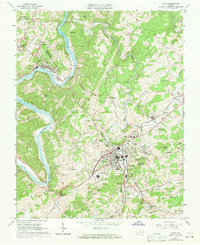
1965 Map of Galax
USGS Topo · Published 1971About this map
The New River carves a dramatic path through the landscape, followed closely by the Norfolk and Western River rail line. This 1965 survey, updated in 1970, captures the industrial and civic heart of the region centered on Galax, where the city corporate boundary meets West Galax and Cliffview. The industrial character of the era is evident in the numerous features along Chestnut Creek, including a Filtration Plant, Sewage Disposal, and several Mine operations near Iron Ridge.
Find a feature on this map
90 named features on this map. Tap any name to fly to it.
Don’t see what you’re looking for? This feature index may not catch every label — zoom into the map to look around manually.
Map Details
Editions of this 1965 Galax Map
4 editions found
Other maps of this area

1889 · Hillsville
USGS Topo · 1:125,000

1889 · Wytheville
USGS Topo · 1:125,000

1892 · Hillsville
USGS Topo · 1:125,000

1892 · Wytheville
USGS Topo · 1:125,000

1896 · Hillsville
USGS Topo · 1:125,000

1930 · Speedwell
USGS Topo · 1:62,500

1930 · Independence
USGS Topo · 1:48,000

1930 · Max Meadows
USGS Topo · 1:62,500

1931 · Galax
USGS Topo · 1:48,000

1933 · Independence
USGS Topo · 1:62,500