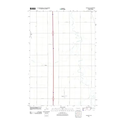
2011 Map of Galchutt
USGS Topo · Published 2011About this map
Galchutt and the surrounding agricultural lands of Richland County are defined by the meandering course of the Wild Rice River, which snakes through the eastern half of this region. The landscape reflects a strict rectilinear survey grid typical of the Red River Valley, with gravel and paved roads like County Rd 4 and County Rd 8 dividing the territory into precise sections. These roads connect small railroad-era settlements and farm clusters, including Colfax in the northwest and the small siding of Enloe in the northeast.
Find a feature on this map
27 named features on this map. Tap any name to fly to it.
Don’t see what you’re looking for? This feature index may not catch every label — zoom into the map to look around manually.
Map Details
Editions of this 2011 Galchutt Map
This is the sole edition of this map. No revisions or reprints were ever made.
Other maps of this area

1895 · Fargo
USGS Topo · 1:125,000

1897 · Fargo
USGS Topo · 1:125,000

1904 · Wahpeton
USGS Topo · 1:125,000

1953 · Fargo
USGS Topo · 1:250,000

1956 · Fargo
USGS Topo · 1:250,000

1959 · Mooreton NW
USGS Topo · 1:24,000
1959 · Walcott
USGS Topo · 1:24,000

1959 · Christine
USGS Topo · 1:24,000

1960 · Galchutt
USGS Topo · 1:24,000

1960 · Mooreton West
USGS Topo · 1:24,000