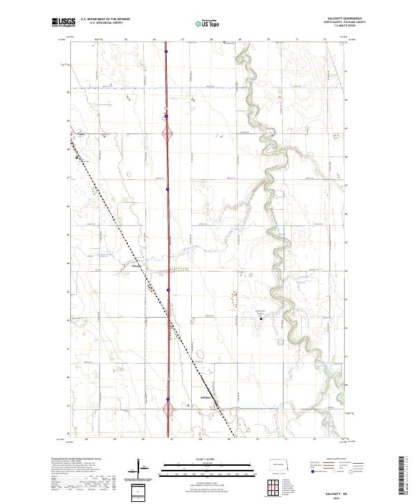
2024 Map of Galchutt
USGS Topo · Published 2024About this map
The Wild Rice River winds through the heart of this Richland County landscape, creating a serpentine corridor of riparian terrain that contrasts with the surrounding agricultural grid. Settlement patterns are anchored by the small communities of Galchutt, Colfax, and Pitcairn, which reflect the rural development of the Red River Valley. Local history is deeply etched into the land through its religious and burial sites, including the Richland Cem in the north and the Our Saviors Lutheran Cem and Bethany Free Lutheran Cem further south. The drainage network is further defined by Pitcairn Creek, which flows eastward toward the primary river, and Antelope Creek in the southeastern corner. Modern infrastructure is represented by a strictly ordered road system of avenues and streets, such as Colfax Ave and Co Rd 6, which facilitate the region's agricultural economy while connecting these historic town sites.
Find a feature on this map
31 named features on this map. Tap any name to fly to it.
Don’t see what you’re looking for? This feature index may not catch every label — zoom into the map to look around manually.
Map Details
Editions of this 2024 Galchutt Map
This is the sole edition of this map. No revisions or reprints were ever made.
Other maps of this area

1895 · Fargo
USGS Topo · 1:125,000

1897 · Fargo
USGS Topo · 1:125,000

1904 · Wahpeton
USGS Topo · 1:125,000

1953 · Fargo
USGS Topo · 1:250,000

1956 · Fargo
USGS Topo · 1:250,000

1959 · Mooreton NW
USGS Topo · 1:24,000
1959 · Walcott
USGS Topo · 1:24,000

1959 · Christine
USGS Topo · 1:24,000

1960 · Galchutt
USGS Topo · 1:24,000

1960 · Mooreton West
USGS Topo · 1:24,000