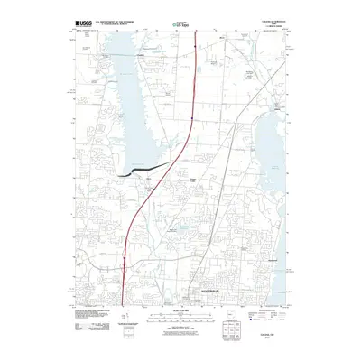
2010 Map of Galena
USGS Topo · Published 2010About this map
Westerville and its northward expansion anchor this 2010 study of Delaware County, where the suburban landscape meets significant water management projects. The map details the proximity of the Hoover Reservoir and Williams Lake, illustrating the impact of the Alum Creek Lake Dam and the Westerville Reservoir Dam on the local topography. Residential development is interspersed with historic sites, including the settlements of Africa, Cheshire, and Galena. Researchers will find numerous small family and community burial grounds, such as the McNamara Cemetery, Peachblow Cemetery, and the Tussig Road Cemetery, which offer valuable data points for genealogical study. The transition from agricultural land to suburban residential tracts is evident in the dense network of local roads like Polaris Pkwy and S Old State Rd, which connect these established communities with newer infrastructure like the Westerville Water Works.
Find a feature on this map
59 named features on this map. Tap any name to fly to it.
Don’t see what you’re looking for? This feature index may not catch every label — zoom into the map to look around manually.
Map Details
Editions of this 2010 Galena Map
This is the sole edition of this map. No revisions or reprints were ever made.
Other maps of this area

1901 · Dublin
USGS Topo · 1:62,500

1902 · Westerville
USGS Topo · 1:62,500

1903 · Dublin
USGS Topo · 1:62,500

1904 · Westerville
USGS Topo · 1:62,500

1915 · Marengo
USGS Topo · 1:62,500

1924 · Delaware
USGS Topo · 1:62,500

1925 · Delaware
USGS Topo · 1:62,500

1943 · Marengo
USGS Topo · 1:62,500

1944 · Delaware
USGS Topo · 1:62,500

1950 · Marion
USGS Topo · 1:250,000