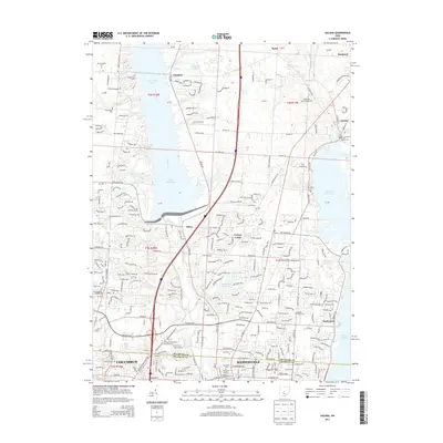
2013 Map of Galena
USGS Topo · Published 2013About this map
Alum Creek Lake and the Hoover Reservoir dominate this 2013 landscape north of Columbus, where expanding suburban footprints meet established rural settlements. The map documents the northern growth of Westerville, featuring prominent institutions like Otterbein College and the University of Phoenix-Columbus Ohio Campus. Historic traces of the area's earlier character remain visible in numerous family and local burying grounds, including McNamara Cemetery and Peachblow Cemetery. Transportation networks such as I-71 and Polaris Parkway illustrate the modern connectivity of the region, while the presence of Grover Airport and smaller communities like Africa and Cheshire highlights a transition from open country to residential development. The alignment of Little Walnut Creek and various ponds further defines the local drainage patterns between these significant water reservoirs.
Find a feature on this map
47 named features on this map. Tap any name to fly to it.
Don’t see what you’re looking for? This feature index may not catch every label — zoom into the map to look around manually.
Map Details
Editions of this 2013 Galena Map
This is the sole edition of this map. No revisions or reprints were ever made.
Other maps of this area

1901 · Dublin
USGS Topo · 1:62,500

1902 · Westerville
USGS Topo · 1:62,500

1903 · Dublin
USGS Topo · 1:62,500

1904 · Westerville
USGS Topo · 1:62,500

1915 · Marengo
USGS Topo · 1:62,500

1924 · Delaware
USGS Topo · 1:62,500

1925 · Delaware
USGS Topo · 1:62,500

1943 · Marengo
USGS Topo · 1:62,500

1944 · Delaware
USGS Topo · 1:62,500

1950 · Marion
USGS Topo · 1:250,000