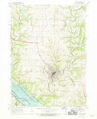
1968 Map of Galena
USGS Topo · Published 1970About this map
The historic mining and river town of Galena is captured here as it appeared in the late 1960s, defined by its steep topography and industrial heritage. The map documents a landscape heavily influenced by lead mining history, with the Appleton Mine and Bower Mine noted alongside several unnamed extraction sites. The Galena River winds through the valley, flanked by the Central Illinois Railroad and an Old Railroad Grade that speaks to the area's once-critical transportation network. To the south, the terrain descends toward the Mississippi River, where the Upper Mississippi River Wild Life and Fish Refuge covers a complex system of islands and channels like Deadmans Slough. Notable landmarks include several religious sites such as St Marys Cem and St Michaels Cem, while prominent elevations like Horseshoe Mound and Pilot Knob provide orientation across West Galena and East Galena.
Find a feature on this map
56 named features on this map. Tap any name to fly to it.
Don’t see what you’re looking for? This feature index may not catch every label — zoom into the map to look around manually.
Map Details
Editions of this 1968 Galena Map
4 editions found
Other maps of this area

1900 · Lancaster
USGS Topo · 1:125,000

1901 · Peosta
USGS Topo · 1:125,000

1902 · Mineral Point
USGS Topo · 1:125,000

1904 · Lancaster
USGS Topo · 1:125,000

1908 · Lancaster
USGS Topo · 1:125,000

1911 · Galena
USGS Topo · 1:62,500

1913 · Galena
USGS Topo · 1:62,500

1935 · East Dubuque
USGS Topo · 1:62,500

1940 · East Dubuque
USGS Topo · 1:62,500

1952 · Cuba City
USGS Topo · 1:24,000