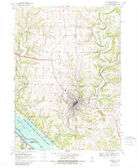
1968 Map of Galena
USGS Topo · Published 1989About this map
The town of Galena is situated at the center of this 1968 topographic survey, where the Galena River cuts through the driftless-area terrain of Jo Daviess County. The map documents a landscape defined by its mineral history and river-based transport, showing the legacy of lead and zinc mining through labels like the Appleton Mine and various mines and gravel pits scattered across the Rawlins and East Galena townships. Prominent elevations such as Horseshoe Mound and Pilot Knob provide distinct landmarks overlooking the complex drainage systems of the Mississippi River, where Deadmans Slough and Harris Slough wind through the Upper Mississippi River Wild Life and Fish Refuge.
Find a feature on this map
44 named features on this map. Tap any name to fly to it.
Don’t see what you’re looking for? This feature index may not catch every label — zoom into the map to look around manually.
Map Details
Editions of this 1968 Galena Map
4 editions found
Other maps of this area

1900 · Lancaster
USGS Topo · 1:125,000

1901 · Peosta
USGS Topo · 1:125,000

1902 · Mineral Point
USGS Topo · 1:125,000

1904 · Lancaster
USGS Topo · 1:125,000

1908 · Lancaster
USGS Topo · 1:125,000

1911 · Galena
USGS Topo · 1:62,500

1913 · Galena
USGS Topo · 1:62,500

1935 · East Dubuque
USGS Topo · 1:62,500

1940 · East Dubuque
USGS Topo · 1:62,500

1952 · Cuba City
USGS Topo · 1:24,000