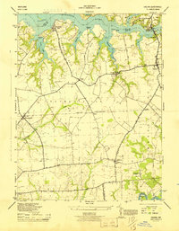
1944 Map of Galena
USGS Topo · Published 1944About this map
The Sassafras River dominates the northern landscape of this mid-century survey, its deeply indented shoreline defining the necks and points of Kent County. River-based commerce is evident at Turner Creek Wharf and Shellcross Wharf, serving a region where water transport and agriculture converged. To the south, the Pennsylvania Railroad (Chestertown Branch) cuts through the interior, connecting inland villages like Kennedyville and Black to the wider rail network. The map records a series of ecclesiastical landmarks vital for genealogists, including Shrewsbury Church, John Wesley Church, and Asbury Ch near the southern border at Chesterville. The terrain transitions from the marshy fingers of Morgan Creek and Woodland Creek to the established woodlands of Chesterville Forest, illustrating the varied rural environment of the Eastern Shore during the 1940s.
Find a feature on this map
48 named features on this map. Tap any name to fly to it.
Don’t see what you’re looking for? This feature index may not catch every label — zoom into the map to look around manually.
Map Details
Editions of this 1944 Galena Map
This is the sole edition of this map. No revisions or reprints were ever made.
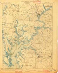
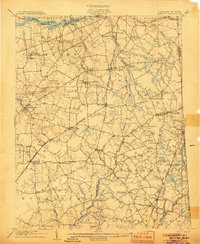
Other maps of this area

1898 · Tolchester
USGS Topo · 1:125,000

1899 · Dover
USGS Topo · 1:125,000

1900 · Cecilton
USGS Topo · 1:62,500

1900 · Betterton
USGS Topo · 1:62,500
1901 · Chestertown
USGS Topo · 1:62,500

1903 · Tolchester
USGS Topo · 1:125,000
1905 · Barclay
USGS Topo · 1:62,500

1906 · Dover
USGS Topo · 1:125,000

1908 · Tolchester
USGS Topo · 1:125,000

1920 · Dover
USGS Topo · 1:125,000