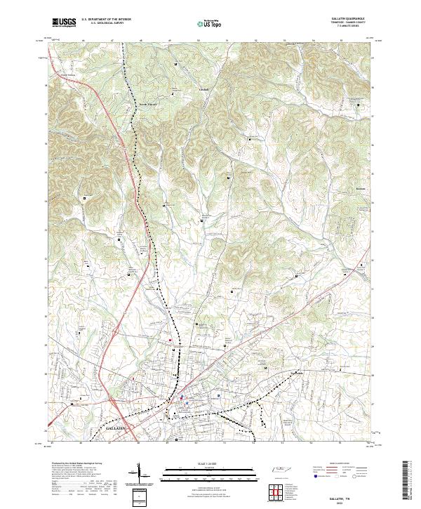
2022 Map of Gallatin
USGS Topo · Published 2022About this map
Gallatin serves as the focal point of this Sumner County landscape, anchored by the Sumner County Courthouse and the nearby Sumner County Criminal Justice Building. The map records a dense collection of family and community burial grounds, such as the Douglass Family Cem, McLin Cem, and the Dry Fork Cumberland Presbyterian Church Cem, which offer significant value for genealogical research in north-central Tennessee.
Find a feature on this map
220 named features on this map. Tap any name to fly to it.
Don’t see what you’re looking for? This feature index may not catch every label — zoom into the map to look around manually.
Map Details
Editions of this 2022 Gallatin Map
This is the sole edition of this map. No revisions or reprints were ever made.
Other maps of this area

1903 · Nashville
USGS Topo · 1:125,000

1931 · Adolphus
USGS Topo · 1:62,500

1942 · Gallatin
USGS Topo · 1:100,000

1952 · Hendersonville
USGS Topo · 1:24,000

1953 · Cottontown
USGS Topo · 1:24,000

1955 · Bethpage
USGS Topo · 1:24,000

1955 · Laguardo
USGS Topo · 1:24,000

1955 · Hunters Point
USGS Topo · 1:24,000

1955 · Gallatin
USGS Topo · 1:24,000
1956 · Portland
USGS Topo · 1:24,000