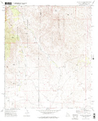
1973 Map of Galleta Flat West
USGS Topo · Published 1976About this map
The Rincon Mountains and Little Rincon Mountains dominate this 1970s landscape along the Pima Co Cochise Co border. Managed largely within the Coronado National Forest and the eastern fringes of the Saguaro National Monument, the terrain is defined by rugged canyons like Cunaro Canyon and Cornfield Canyon. Grounded in the mid-century ranching and spiritual life of the region, the map identifies isolated outposts such as Mackenzie Ranch and the Ashrama Ranch, alongside the White Cross Cemetery south of Agua Verde Creek.
Find a feature on this map
31 named features on this map. Tap any name to fly to it.
Don’t see what you’re looking for? This feature index may not catch every label — zoom into the map to look around manually.
Map Details
Editions of this 1973 Galleta Flat West Map
2 editions found
Other maps of this area

1904 · Patagonia
USGS Topo · 1:125,000

1904 · Tucson
USGS Topo · 1:125,000

1905 · Patagonia
USGS Topo · 1:125,000

1905 · Tucson
USGS Topo · 1:125,000

1915 · Benson
USGS Topo · 1:125,000

1926 · Whetstone
USGS Topo · 1:62,500

1943 · Benson
USGS Topo · 1:125,000

1945 · Happy Valley
USGS Topo · 1:62,500

1956 · Nogales
USGS Topo · 1:250,000

1956 · Tucson
USGS Topo · 1:250,000